
Free 3D Data Capture to Exploitation Pipeline
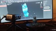
⊲ DroneDJ ⊳ DroneDJ reports that DJI has launched DJI Reality, a free Windows-based 3D model viewer within DJI Terra, aimed at making drone mapping data easier to open, share and present. The tool supports mesh models, point clouds and 3D Gaussian Splatting, with features including multi-model viewing, guided fly-throughs and 4K output. The article says DJI is building a tighter software chain from capture to presentation, giving construction, surveying and public safety teams a simpler way to handle large spatial datasets.
⊲ Image – DJI ⊳
www.simulation.news