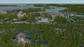
⊲ Remograph ⊳ Remograph, based in Linköping, Sweden, announced the release of Remoscape v1.5, its tool for generating 3D landscapes for realtime visualisation. The update brings improved LiDAR...

Simulation news including XR, digital twins, immersive tech and metaverse
⊲ Remograph ⊳ Remograph, based in Linköping, Sweden, announced the release of Remoscape v1.5, its tool for generating 3D landscapes for realtime visualisation. The update brings improved LiDAR...
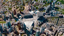
⊲ Space Daily ⊳ Vantor, the Earth observation company formerly known as Maxar, has launched WorldView 3D, a service producing daily updated three dimensional maps of Earth accurate to 15...
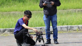
⊲ The Drone Front ⊳ Taiwan’s Aerospace Industrial Development Corp has introduced AIxVNAV, an AI-powered navigation system that enables drones to operate when GPS signals are unavailable or...
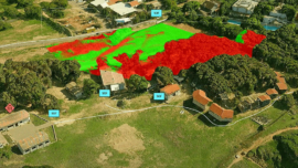
⊲ OneArc ⊳ BAE Systems OneArc has signed a global reseller agreement with Skyline Software to bundle PhotoMesh into its SceneCast solution, creating an end-to-end workflow from drone survey to...

⊲ Unity ⊳ Google has integrated Immersive View into Android XR, allowing users to explore the globe with a more immersive experience. By using the Unity engine, the team successfully bridged...
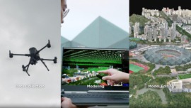
⊲ DroneDJ ⊳ DJI has released an update for its AI-powered 3D modelling and point cloud editing software, Modify, aimed at professionals in fields like surveying and construction. The new version...

SAE Media Group | Researchers are using AI to improve the mapping of 3D spaces using 2D images. This approach leverages machine learning to infer depth and spatial relationships, enabling more...